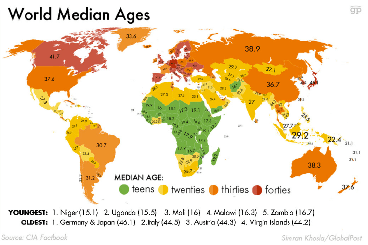
The map below displays countries by the median age per citizen. Germany and Japan are the world’s oldest countries with an average age of 46; Conversely, Niger and Uganda are the world’s youngest countries with an average age of 15!
This map signals the future population tends coming — Europe is the world’s oldest continent by median age has been enmeshed in economic stagnation and debt crises (likewise for Japan) — These trends are likely to persistent into the future. Africa is the world’s youngest continent and is full of potential and economic growth. The current projections are Africa’s population will double from 1 billion to 2 billion people in the next 30 years. These drastic demographic changes are likely to upheave society (and possibly governments) in the region as these energetic youngsters will reshape the status quo.
 This representation is a borderless 3-dimensional world population map. The map does a great job of depicting the world’s population concentration zones in East Asia, Europe, North America, etc. What is striking is not only do oceans separate population centers from one another, but large stretches of desolate land – which are essentially operating like waterways – cutting some parts of the world off from others. For example, the Sahara separating North Africa from Sub-Sahara Africa, the Amazon in Brazil, the Himalayas between India and China, and the outback deserts make Australia almost non-existent on the map.